Ambitions impériales en cartes et plans

-
L'Amérique angloise, ou description des isles et terres du roi d'Angleterre dans l'Amérique R. Blome. 1688

-
Québec, ville de l'Amérique septentrionale dans la Nouvelle France avec titre d'eveché H. Van Loon. 1694
-
Partie du Canada ou nouvelle France et de la Nouvelle Angleterre, de l'Acadie de La Guer de Marville. 1713
-
A new map of the north parts of America claimed by France H. Moll. 1720
-
A map of the British Empire in America with the French and Spanish settlements 1733

-
A map of the British Empire in America with the French and Spanish settlements adjacent thereto H. Popple. 1733
-
A map of the British Empire in America 1741

-
Amérique Septentrionale J.-B. Bourguignon d'Anville. 1746
-
A map of the Britisch [sic] Empire in America with the French [...] H. Popple. 1755
![A map of the Britisch [sic] Empire in America with the French [...]<br>H. Popple. 1755](https://iiif-cloud.princeton.edu/iiif/2/ea%2F7d%2Fa7%2Fea7da7a97e0743439083d0523f9319b5%2Fintermediate_file/square/225,/0/default.jpg)
-
A Map of the British and French settlements in North America 1755

-
A new and accurate map of the English empire in North America 1755
-
A New Map of Nova Scotia, and Cape Britain. With the adjacent parts of New England and Canada 1755
-
Canada, Louisiane et terres angloises J.-B. Bourguignon d'Anville. 1755
-
Carte des possessions angloises & françoises du continent de l'Amérique septentrionale 1755
-
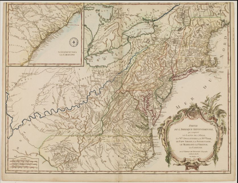
Partie de l'Amérique septentrionale G. R. de Vaugondy. 1755

-
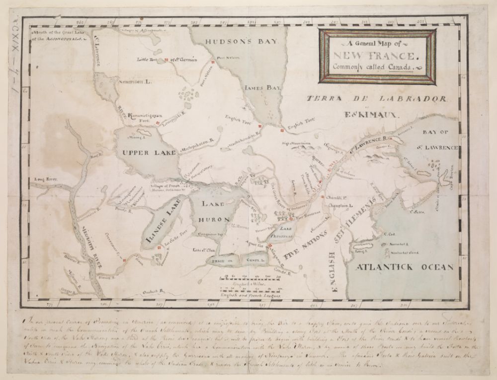
A General Map of New France. Commonly called Canada 1755-1760

-
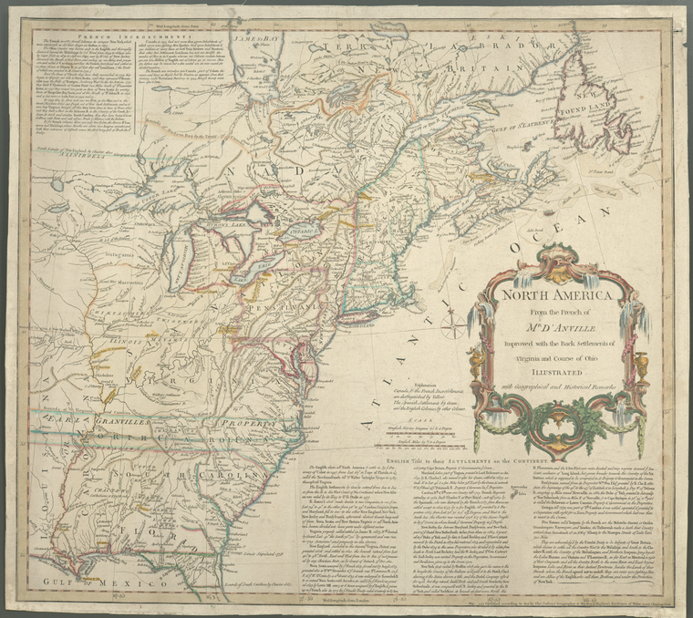
North America from the French of Mr. D'Anville : improved with the back settlements of Virginia and course of Ohio 1755
-
Carte des possessions françoises et angloises dans le Canada, et partie de la Louisiane Longchamps. 1756
-
Carte du Canada et de la Louisiane qui forment la Nouvelle France et des colonies angloises, où sont representez les pays contestez J. B. Nolin. 1756
-
Giusta rappresentazione del diritto di sua Maesta' Britannica sopra la Nuova Scozia 1756

-
Plan de la ville de Louisbourg en 1757 1757
-
A plan of the city and harbour of Louisburg with the French batteries that defended it and those of the English shewing that part of Gabarus bay R. Gridley. 1758
-
Plan du fort Carillon et du Camp retranché pour s'opposer à l'attaque des Anglais, avec l'ordre des colonnes à l'action du 8 Juillet 1758 1758
-
A new and accurate map of the present war in North America 1760
-
Plan of the attack against Basse Terre on the island of Guadaloupe by a squadron of his Majesty's Ships of War. E, Rycaut. 1760
-
Plan of the attack against Fort Louis now Fort George, at Point à Pitre on the island of Guadaloupe. E. Rycaut. 1760
-
La Luisiana cedida al Rei N.S T. López. 1762
-
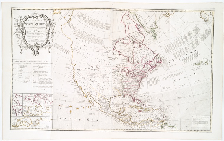
A new map of North America: with the British, French, Spanish, Dutch & Danish dominions 1763
-
A New Map of the province of Quebec according to the royal proclamation of the 7th of october 1763 1775
-
A map of the inhabited part of Canada, from the French survey C. J. Sauthier 1777
-
Carte de la Dominique prise par les François le 7 septembre 1778. J-N. Buache
.png)
.png)

