bloc_article_content
The “Dépôt des cartes et plans de la Marine”
Many French maps of North America can now be found in the collection of the Service Hydrographique de la Marine at the Bibliothèque Nationale de France.
This rich collection, including many maps made in the Americas, comes down to us from the Dépôt des cartes et plans de la Marine, the main site for the collection, production, and distribution of geographical knowledge about the French colonial empire.
In 1699, Louis Phélypeaux, Count of Pontchartrain and Secretary of State for the Navy, set up his own archive on the premises of the monastery of Les Petits-Pères, near Place des Victoires in Paris. Many cartographic documents and ships’ logbooks were transferred there, but, forgotten as soon as they had been archived, they did not prove particularly useful. This prompted the Conseil de la Marine (Naval Council) to create the Dépôt des cartes, plans et journaux de la Marine in November 1720, absorbing Pontchartrain’s collection of sea charts, plans, logbooks, and nautical writings. An experienced officer was appointed its director and charged with examining the documents sent in by naval captains at the end of each voyage. This fresh material was initially stored with the rest of the naval archive at the monastery of Les Petits-Pères, in a separate room that was kept locked.
Two cartographers had brilliant careers in the Dépôt: Philippe Buache and Jacques-Nicolas Bellin. Buache, a student of Guillaume Delisle, worked there as a hydrographer (a specialist in the depiction of seas and water courses). He produced the first maps issued by the Dépôt, all of which remained in manuscript form. One of the first seems to have been his map of the Antilles and of the Gulf of Mexico (1724). Even after he was appointed assistant geographer of the Académie Royale des Sciences in 1730, Buache remained attached to the Dépôt and worked on refining maps of the Saint Lawrence River based on fieldwork carried out by naval officers. In 1737, his maps of the Saint Lawrence Gulf and River were ready to be printed and published, but, for reasons unknown, they never saw the light of day. That same year, he left the Dépôt.
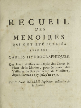
The Dépôt also sought out a capable assistant geographer who could draw well and keep the registers in order. Bellin occupied this position as of 1721 and took over as the main cartographer of the Dépôt after Buache’s departure. He then applied for the position of hydrographic engineer, which he obtained four years later (1741). Whether as assistant or director, Bellin contributed much to refining maritime cartography that interested the French Navy.
As a small but centralized facility for the collection, treatment, analysis, and calculation of data, the Dépôt employed several technicians who placed, corrected, and removed dots and lines from maps. It provided copies of maps to naval captains before their departures for Quebec, Louisbourg, or Louisiana, along with lists of “remarks” on geographical uncertainties to be verified in the field. Every new naval campaign prompted a series of new questions; every returned report contributed to the expansion of navigational knowledge. The Dépôt standardized and systematized both information gathering, by providing navigators with identical templates for their journals, and information distribution, by requiring the use of a definitive grid of latitudes and longitudes on maps – a most uncommon practice for sailors at the time.
Some of the maps in the Dépôt’s collection bear explicit mentions of their provenance and their source’s route to and from the Americas. The collection also includes maps hand-drawn in pencil, which navigators were asked to correct, enhance, and return to the Secretary of State, who then transferred them to the Dépôt.
Unsurprisingly, the collection skews heavily toward the European and international zones frequented by the French Navy. Frequent naval campaigns gave the Dépôt the data to compile not only small-scale maps of oceans, but also more detailed maps of certain critical areas, such as the Gulf of Mexico, the Gulf of the Saint Lawrence, and the Saint Lawrence River.
The first map of the Atlantic Ocean published by the Dépôt was Carte réduite de l’océan Occidental (1738). It was printed, meaning the Dépôt could distribute identical basic maps to navigators and receive the largest possible number of synchronized observations in return – a wealth of updated information on coasts, harbors, anchorages, and water depths. Over 400 copies of the Atlantic map were distributed at French ports, and Maurepas, the Secretary of State for the Navy, sent it to captains selected for naval campaigns at Île Royale (now Cape Breton Island) and in Canada. The map was even counterfeited in London, a sign of its general appeal, and was updated four times over a period of 30 years. Requiring navigators use and correct a standardized ocean map based on clearly identifiable fixed points proved to be a huge success.
Using the cartography of the Marquis de l’Estanduère, the Dépôt also produced a more detailed map of the Saint Lawrence River, which served as a sort of framework for subsequent maps, but it was never published for reasons of colonial security.
The cartographers of the Dépôt, charged with the consolidation of geographical information for naval and colonial purposes, worked to improve maps of continental interiors as well as coastlines and waterways. This can be seen, for instance, in the 28 maps made by Bellin to accompany Father Charlevoix’s Histoire et description générale de la Nouvelle-France, an unprecedented publishing venture that released a century’s worth of French geographical knowledge to the public.
Published in may 2021
Réduire l'article ^


