The fall of New France
Louis-Joseph de Montcalm (1712-1759)
General Montcalm stayed for just three years in Canada, from 1756 to 1759. He led a series of victories before being defeated before Quebec, the capital of New France. His death on the “field of honour” assured that he has a special place in the memory of the Seven Years War.
Dave Noël, historian.
Military campaign

-
Carte d'une partie du Lac Supérieur avec la découverte de la rivière depuis le grand portage A jusqu'au lac Ouinipigon G.-J. Chaussegros de Léry. 1724
-
Capitulation du Fort Necessity 1754
-
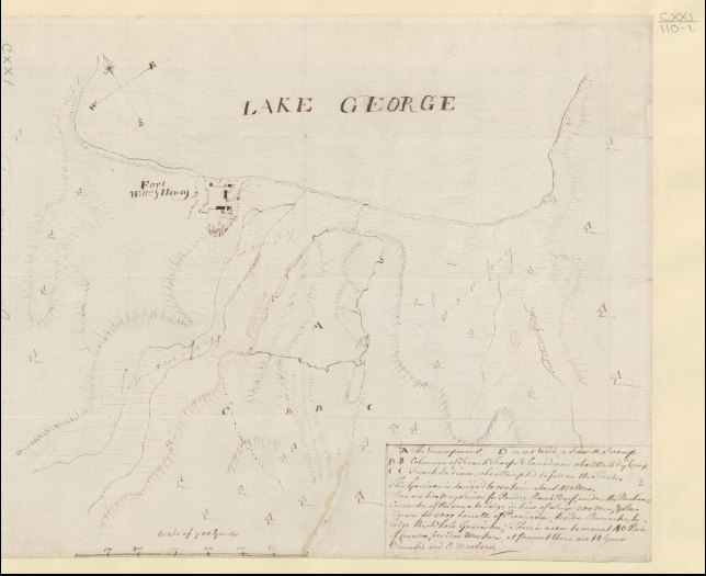
Fort William Henry and environs W. Eyre. 1755
-
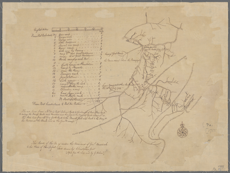
The route of the army under the command of Genl. Braddock to the place of their defeat C. Gist. 1755
-
Carte des possessions françoises et angloises dans le Canada, et partie de la Louisiane, 1756.

-
Declaration du roy , concernant les armemens de mer qui se font pour la course sur les ennemis de l'Etat 1756
-
Noticia certa da tomada, e rendimento de Cabo-Berton, cuja praça se rende aos Inglezes, ficando toda a guarnicaõ prizioneira de guerra 1758
-
Songs of Victory directed by Human Compassion , and qualified with Christian Benevolence; in a sermon delivered at Roxbury, October 25, 1759

-
Genuine Letters and Memoirs relating to the natural, civil and commercial history of the Islands of Cape Breton, Saint John, from the first settlement there, to the taking of Louisburg by the English, in 1758 1760

-
Sorrow turned into Joy. A sermon deliver'd at Medfield, October 25, 1759, being a day of public acknowledgement of the smiles of heaven upon the British Arms in America 1760

-
The Terrible Calamities that are occasioned by War, and the blessedness of a people that live under the protection of God T. Smith. 1760

-
Letter, Etienne-Francois, Duc De Choiseul, to Jean-Jacques-Blaise D'abbadie 1764
-
Pierre-Joseph Neyon de Villiers, Fort Chartres, to Jean-Jacques-Blaise D'Abbadie 1764
-
An historical journal of the campaigns in North-America, for the years 1757-1760 J. Knox. 1769

-
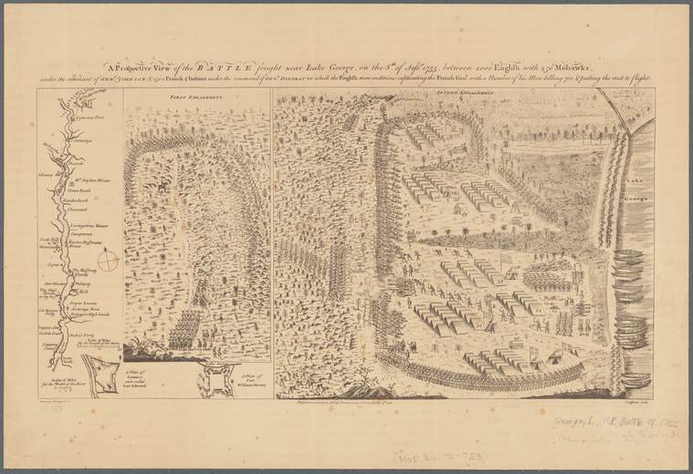
A Prospective View of the Battle fought near Lake George S. Blodget. 1778
-
A View of the Landing [in] the New England Forces in ye Expedition against Cape Breton. J. Stevens. 1779
-
Certificate of naval service of Boileau de St. Paul in Canadian campaign of 1758 1782

-
Reminiscences , 1755-1762: including the Louisburg and Quebec campaigns, manuscript H. Hamilton. 1792

-
A prospective view of the battle fought near Lake George, on the 8th of Sepr. 1755, between 2000 English, with 250 Mohawks 1800
-
Mémoire du sieur de Ramezay, commandant à Québec, au sujet de la reddition de cette ville 1861
-
Journal du voyage de M. Saint-Luc de La Corne dans le navire l'Auguste, en l'an 1761 1863
-
Le Massacre au fort George, la Mémoire de Montcalm vengée, documents historiques 1864
-
Historic handbook of the northern tour F. Parkman. 1885

-
Le grand vaincu : dernière campagne du marquis de Montcalm au Canada H. Cauvain. 1885
-
Les français au Canada : Montcalm et Lévis H.-R. Casgrain. 1913
-
Collection Dionis Du Séjour . Règne de Louis XV. Canada
War in maps

-
Carte pour servir à l'éclaircissement du papier terrier de la Nouvelle-France J.-B. Franquelin. 1678
-
Carte générale de Canada L. A. de Lom d'Arce, baron de Lahontan. 1715
-
Lake Ontario & River St Lawrence from the lake to Fort William Augustus' in three pieces, taken from a French draft 1750

-
Plan of Fort Wm Henry and the English camps & retranchment with the French different camps & attack thereon 1750

-
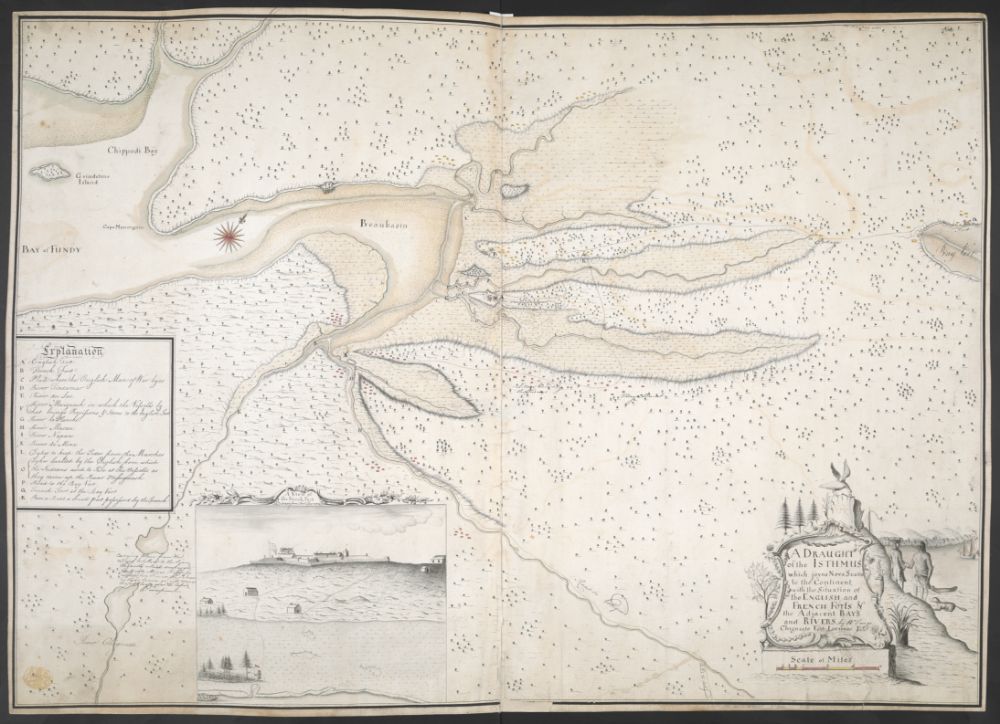
A draught of the Isthmus which joyns Nova Scotia to the Continent with the Situation of the english and french forts W. Tonge. 1755
-
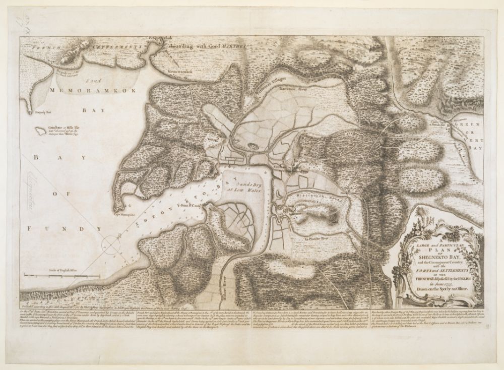
A large and particular plan of Shegnekto bay, and the circumjacent country, with the forts and settlements of the french'till dispossess'd by the english 1755
-
A large and particular plan of Shegnekto Bay, and the Circumjacent Country, with the Forts and Settlements of the French T. Jefferys. 1755
-
Plan of fort Le Quesne built by the french at the Fork of the Ohio and Monongahela in 1754 1755
-
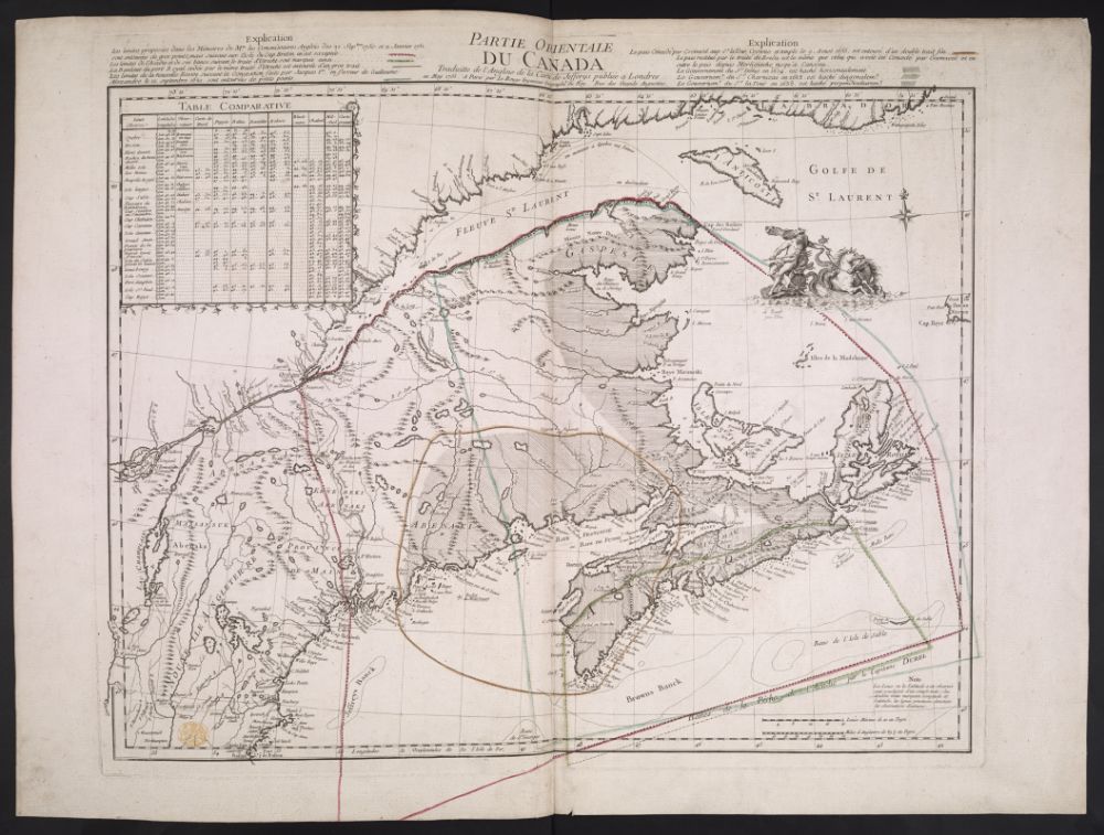
Partie orientale du Canada. Traduite de l'Anglois de la carte de Jefferys 1755
-
A map showing the northern part of Lake George and Fort Ticonderoga 1756

-
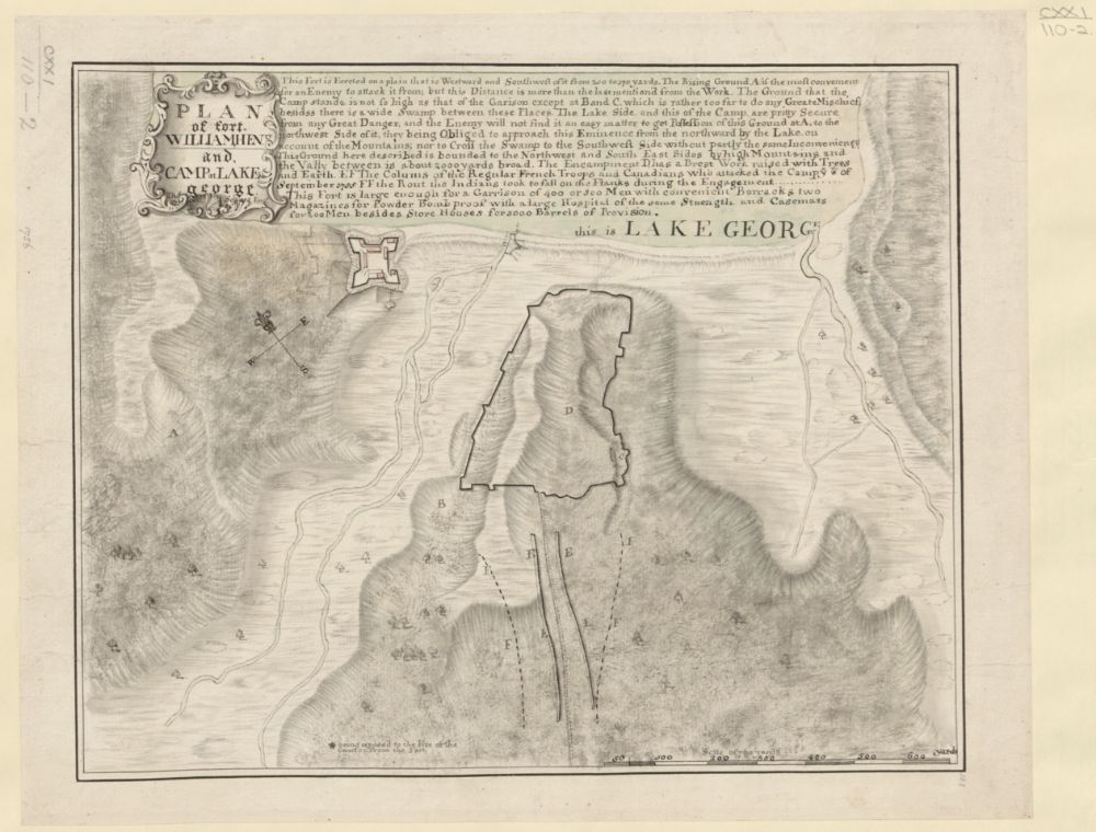
Plan of fort William henry and Camp at Lake george T. Sowers. 1756
-
Plan of the town and fortifications of Montreal or Ville Marie in Canada T. Jefferys. 1758
-
Plan of the Action on the Heights of Abraham near Quebec. Septr. 13th 1759
-
Plan of a rout (...), from Quebec, the capital of Canada, to the frontier settlements of the Township of Topsham J. Montrésor. 1760

-
A map of the sources of the Chaudière, Penobscot, and Kennebec rivers J. Montrésor. 1761

-
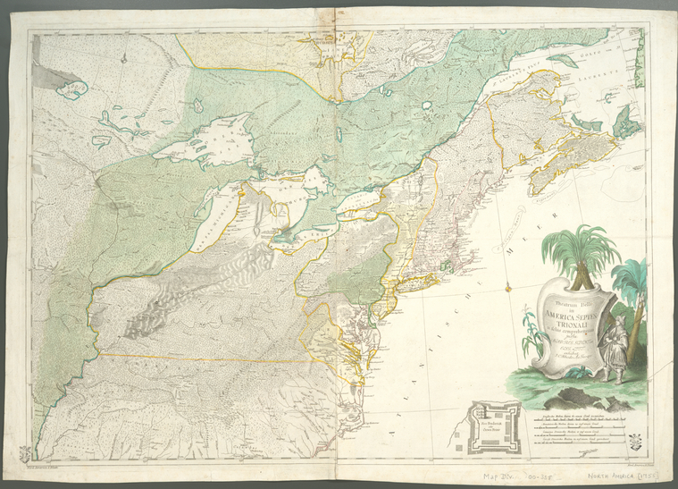
Theatrum belli in America Septentrionali : II. foliis comprehensum J. Rhode. 1761
-
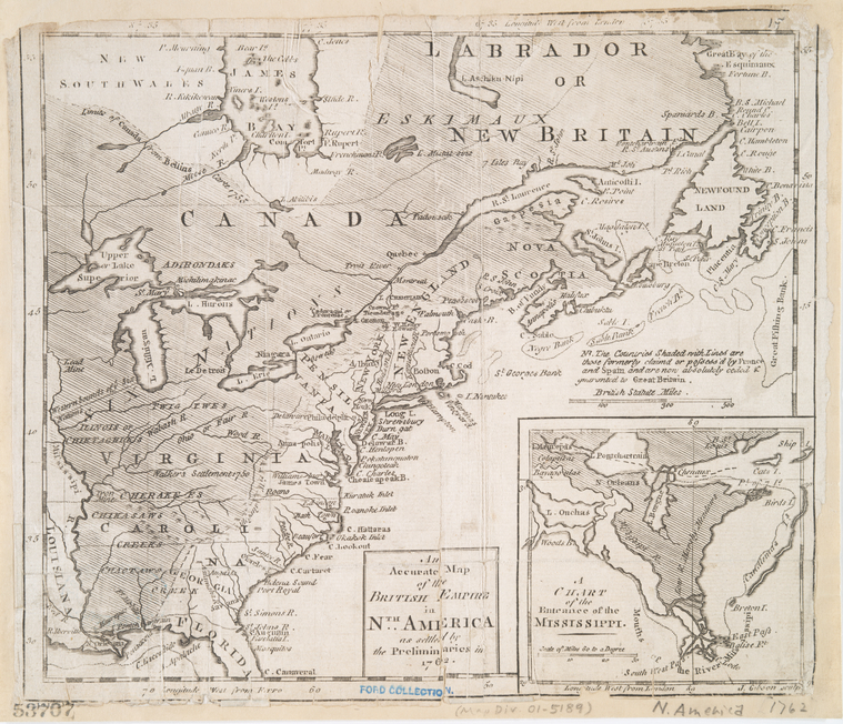
An accurate map of the British Empire in Nth. America as settled by the preliminaries in 1762 J. Gibson. 1762
-
A survey of Lake Champlain, from Crown Point to Windmil Point W. Brasier. 1762

-
Map of Nova Scotia, or Acadia J. Montrésor. 1768

-
Plan of the Action on the Heights of Abraham 28th. of April 1760 1774
-
The Draught of Genl. Braddocks Route towards Fort DuQuesne 1777
-
Plan of the Town and Fortifications of Montreal or Ville Marie in Canada T. Jefferys. 1779
-
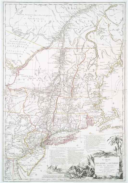
Carte du théatre de la guerre entre les Anglais et les Américains dressée d'après les cartes anglaises les plus modernes 1782
-
Carte du port de Louisbourg et de ses environs
Economic impact

-
Chemin de Québec à la baye Françoise 17e
-
Roman politique sur l'état présent des affaires de l'Amérique P.-L. de Saintard. 1757
-
An enquiry into the value of Canada and Guadaloupe 1761

-
Lettre de Bernard Duvernet au ministre Choiseul sur la perte du Canada et ses conséquences pour la France 1761
-
Mémoire sur le Canada P. Glemet. 1763
-
Carte des Isles de Miquelon et de St. Pierre et la coste de Terre- Neuve voisine J. N. Bellin. 1764
-
Observations sur la dette de Canada P. Glemet. 1764
-
Arrest du conseil d'état du Roi, qui ordonne que les billets de monnoie du Canada, de propriété angloise, seront admis à la liquidation 1766
-
Note sur les billets de Canada P. Glemet. 1766
-
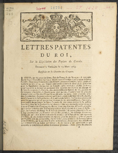
Lettres patentes du roi, sur la liquidation des papiers du Canada, données à Versailles le 12 mars 1769
-
Réclamations à l'Assemblée-Nationale en faveur des anciens habitans de l'Acadie transportés en France lors de la prise de Louisbourg 1790

Stakes of the Treaty of Paris

-
Carte minéralogique où l'on voit la nature des terrains du Canada et de la Louisiane P. Buache. 1752
-
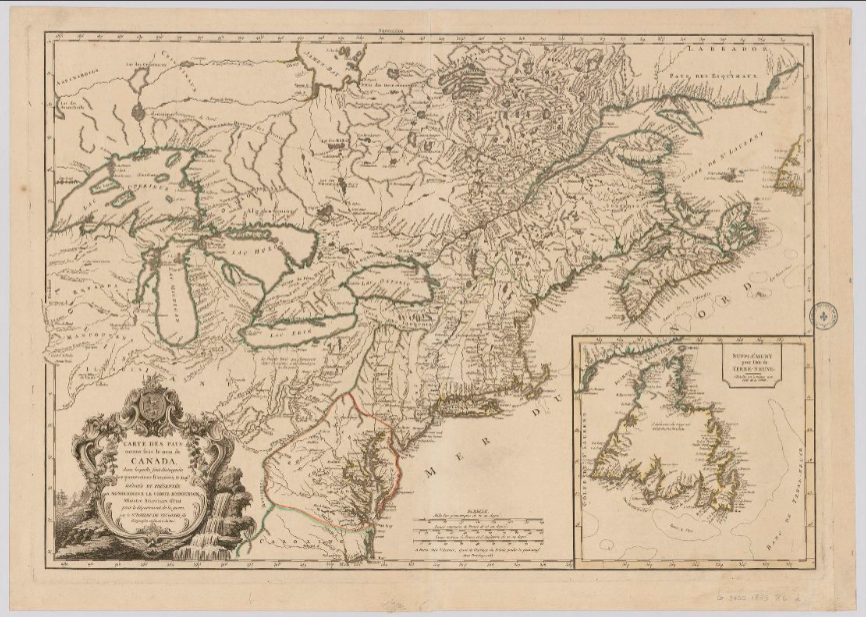
Carte des pays connus sous le nom de Canada, dans laquelle sont distinguées les possessions françoises, & angl? D. R. de Vaugondy. 1753
-
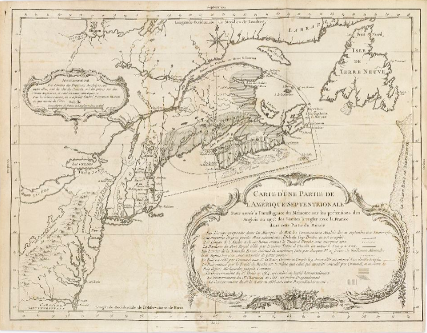
Carte d'une partie de l'Amérique Septentrionale 1755
-
Letters s. by the Duc d'Aiguillon to de Boynet; saying that certain claims of Pierre de Rigaud, marquis de Vaudreuil-Cavagnal, could not be considered 1760

-
France. Sovereign (1715-1774 : Louis XV) 1761

-
Mémoire historique sur la négotiation de la France et de l'Angleterre, depuis le 26 mars 1761 jusqu'au 20 septembre de la même année E. F. duc de Choiseul. 1761
-
Articles préliminaires de paix entre le Roi, le roi d'Espagne et le roi de la Grande-Bretagne . Signés à Fontainebleau le 3 novembre 1762
-
Arrest du conseil d'état du roi, portant règlement sur les charte-parties d'affrètement, passées avant la signature des préliminaires de la paix 1763
-
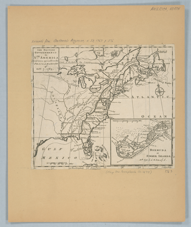
The British governments in Nth. America : laid down agreeable to the proclamation of Octr. 7, 1763
-
Traité de paix entre le Roi, le roi d'Espagne et le roi de la Grande-Bretagne, conclu à Paris le 10 février 1763 . Avec l'accession du roi de Portugal 1763
-
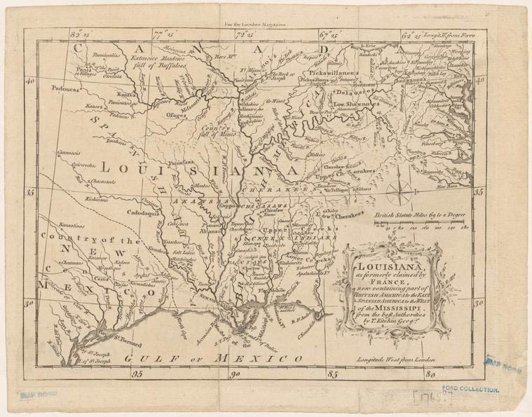
Louisiana, as formerly claimed by France : now containing part of British America to the east & Spanish America to the west of the Mississipi 1765
-
Lettre circulaire, datée du 11 août 1755 (...) expliquant les raisons de la déportation des Acadiens 1784
-
The critical period 1763-1765 C. W. Alvord. 1915

-
The new régime, 1765-1767 C. W. Alvord. 1916

.png)
.png)
