• content
  • Menu
  • Footer
logo BnF logo partenaire

Header

  • Homepage
  • Project
  • About us
×
  • Homepage
  • Project
  • About us
  • en English
  • fr Français
  • ar العربية
  • en English
  • fr Français
  • ar العربية

Menu éditorial

  • Crossroads
  • Religions
  • Communities
  • Knowledge
  • Politics
  • Imaginary
  • Personalities
  • Crossroads
    • Sites
      • Egypt
        • Alexandria
          • Alexandria
          • Maps and plans of Alexandria
        • Cairo
        • Drawings of sites and views from the "Description of Egypt"
        • Images and views of Egypt
          • "Le Caire dans l'Album universel"
      • Turkey
        • Constantinople / Istanbul
          • Maps and plans of Istanbul
          • The fire insurance maps of Istanbul
          • Photograps of Istanbul
        • Turkey
      • Iraq
      • Jordan
      • Lebanon
      • Palestine
      • Syria
        • Maps and plan of Syria
        • Damascus
      • Army of the Levant : Aerial photos of Syria and Lebanon
    • The Nile
    • The Suez canal
      • Genesis, studies and testimonies
      • Official documents
      • Maps of the Canal
      • Photographs of the Canal
    • Railroads
      • Alexandria's tramway
        • Alexandria - Ramlah Line
      • Railways
    • Journeys
      • Guides books for the travelers in Orient
        • Traveler's night
      • European narratives
      • Oriental narratives
    • Trade
      • The Imperial Ottoman Bank
      • Bills of exchange
      • Capitulations
      • Ordonnances
        • Decrees
      • National economies
      • Levant ports
    • "Expositions universelles"
      • "Expositions universelles"
      • The Rue du Caire
  • Home
  • Crossroads
  • The Nile
The Nile
Afficher sous forme de liste
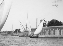
  • Photographies du Nil Collection Max Karkegi

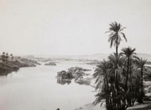
  • Photographies du Nil Fonds Henri Duval

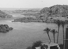
  • Photographies du Nil Fonds André Robert. 1911-1931

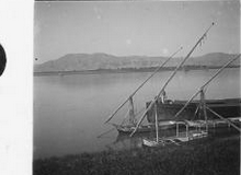
  • Photographies du Nil Fonds Jules Touzard. 1931

  • Carte hydrographique de la Basse Égypte P. Jacotin. 1810

    Carte hydrographique de la Basse Égypte <br> P. Jacotin. 1810
  • Le Nil : Égypte et Nubie M. du Camp. 1860

    Le Nil : Égypte et Nubie <br> M. du Camp. 1860
  • Statistique graphique des élévations annuelles du Nil du 1er janvier 1849 au 31 décembre 1878

    Statistique graphique des élévations annuelles du Nil du 1er janvier 1849 au 31 décembre 1878

Copyright BnF - 2025

  • Mentions légales
  • C.G.U.
  • Plan du site
  • Accessibilité
//tag.aticdn.net/18798/smarttag.js
The_Nile
Bibliotheques_d_Orient
66
  • logo FB
  • ff
  • logo twitter
  • dds